The territory is in constant transformation. New developments emerge, population flows shift, socioeconomic profiles change, and urban dynamics reorganize themselves in increasingly shorter cycles. In such a scenario, making strategic decisions based on outdated data means taking on invisible risks that directly impact the profitability, positioning, and sustainability of any investment. Companies that fail to keep up with this evolution end up making decisions about a territory that no longer exists.
Feasibility Studies: The Geodata Turnaround — From Technical Resource to Strategic Asset
The phase of feasibility studies Feasibility studies in real estate are a crucial step in detailed analysis to determine if a project is profitable, sustainable, and feasible before investing significant time and resources. It functions as a "test" to assess the potential risks and returns of the venture.
Today, up-to-date geodata has gone from being a technical resource to a strategic asset. It allows us to understand where the real opportunities are, which areas are growing or saturated, and how the market is behaving in the present. Without this updating, market analyses lose accuracy, projections become distorted, and investment risk increases significantly.
Making decisions based on outdated data has direct consequences: poorly positioned businesses, stores opening in areas with declining foot traffic, inefficient logistics operations, and public investments with low impact. The problem lies not in the project or the strategy, but in the incorrect interpretation of the territory, based on information that does not keep pace with its evolution.
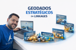
From Satellite to Strategy: How Linkages transforms satellite imagery into geospatial intelligence.
This is where Linkages differentiates itself in the market. The company uses constantly updated, high-resolution satellite imagery to identify real changes in the territory. From these images, it is possible to detect new developments, urban expansion, changes in land use, growth in built-up areas, changes in infrastructure, and transformations that do not yet appear in traditional databases or official censuses.
Geospatial Analysis that Goes Beyond the Map: Integrated Data, Territorial Reading, and Predictive Vision
Linkages doesn't just deliver maps or visualizations. Satellite imagery is combined with advanced geospatial analysis, cross-referencing socioeconomic, demographic, mobility, consumption, and competitive data. This process generates a deep understanding of the territory, connecting physical space with market behavior. The result is a clear, objective analysis that is directly applicable to decision-making.
One of the key differentiators of Linkages' methodology is its temporal analysis, which compares different periods and identifies trends of growth, appreciation, stagnation, or decline. This allows for anticipating market movements, reducing uncertainty and supporting safer decisions. Instead of looking only at the current scenario, the company offers a view of territorial evolution, essential for those thinking in the medium and long term.
Less Guesswork. More Precision: The Linkages methodology applied to decision making.
With up-to-date and analyzed geodata, decisions are no longer based on isolated perceptions or experiences. Linkages delivers measurable, comparable, and interpretable data that supports everything from choosing an area or plot of land to defining expansion strategies, pricing, and market positioning.
By deeply understanding the territory, companies can invest more efficiently, reduce operational risks, and maximize return on capital. Linkages' territorial intelligence allows them to answer the most critical business questions: where to invest, when is the best time, and what factors underpin that decision.
Unlike solutions that only provide platforms, Linkages delivers results! The methodology comes already applied, interpreted, and connected to the client's strategy, eliminating the need to assemble complex internal teams or deal with multiple disconnected data sources.
Why market leaders trust territorial intelligence.
In today's landscape, those who make decisions based on up-to-date data make better decisions. Companies that utilize Linkages' geospatial intelligence gain clarity, predictability, and a competitive advantage. Because, ultimately, the success of an investment depends on the ability to see the territory as it truly is—not as it once was.