Geospatial analysis has ceased to be a technological differentiator and has become the core of strategic decisions in the modern real estate market. Developers, construction companies, funds, and asset managers who use market intelligence with geotechnology are able to reduce risks, accelerate processes, and identify opportunities invisible to traditional methods.
Transforming geodata into decisions worth millions.
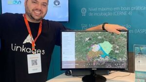
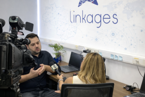
This is precisely where Linkages stands out — with a methodology and geotechnology led by Dr. Lucas Baldoni, a geographer specializing in territorial intelligence applied to the market. His scientific and practical vision has led to the creation of solutions that combine robust methodology, academic precision, and direct commercial impact.
Real Case Study: Identifying promising areas and accelerating the real estate sales pipeline.
In the case of Linkages, a construction company drastically reduced its analysis time by adopting a method that cross-references georeferenced data such as: zoning, land use and occupation, population density, mobility, consolidated infrastructure, social and economic data.
Practical results observed by the client:
Reducing the time needed to filter potential areas from weeks to just a few hours.
Elimination of rework
Decisions based on technical criteria and official data.
A consolidated overview of the constraints and potential of each area.
This delivery was only possible thanks to the methodological rigor combined with the geospatial technology of Linkages, structured by Dr. Lucas Baldoni, focused on automating analyses and delivering to the client only what matters: the result ready for decision-making.
AI applied to location: Project approved by FAPESP boosts market intelligence.
Linkages received official support from FAPESP in 2023 for the development of a pioneering Artificial Intelligence model applied to geospatial analysis — a project technically led by Dr. Lucas Baldoni.
Direct benefits for the real estate market:
Automatic identification of the best regions for developments.
Predictive models that warn of future areas of appreciation.
Cross-referencing dozens of databases simultaneously.
Reducing human error and achieving economies of scale in analytics.
Intelligent visualization for strategy: Maps clarify analysis.
The method and tools developed by Linkages allow you to see everything that matters on a single map, for example:
Potential demand,
Urban characteristics
Service infrastructure
Areas with a tendency to appreciate in value.
Competition and market saturation.
This centralization allows the client's team to make faster, safer decisions with a stronger technical foundation.
Results in numbers: The competitive advantage of those who base decisions on data.
Linkages' geospatial intelligence provides numerous benefits and impacts on the real estate market. Accelerating the feasibility study phase is one of them, reducing the time from weeks to just a few hours. Error reduction in analyses is achieved thanks to methodology and automation. Finally, greater accuracy in land purchases results in a significant increase in the success rate. Linkages doesn't just deliver maps. Linkages delivers confidence, precision, and speed in location decisions.