Databases function as a large information center, organized in such a way that visualization, retrieval and even cross-referencing are possible.
However, data can be classified into more than one category. To learn more about this subject, read our article: Data, how much we generate and how it turns into insights.
In Brazil, there are several databases, both public and private. However, these databases are not very well organized and their availability is scarce.
The country's rapid growth is one of the reasons why it is so difficult to keep these databases up to date. Then Brazil is the sixth most populous country in the world, with more than 213 million people, according to the IBGE. In addition to being the fifth largest in land area.
This, added to the rapid advancement of technology, which allows the constant capture of new information to measure, contribute to this scenario of undervalued information.
But why is it so important to have organized databases?
Data essentially represents units of information.
In isolation, they have little value. However, when associated with other units and placed in context, they become the greatest asset of this century.

With organized databases, combined with the knowledge of specialists and new technologies, it will be possible to make more assertive decisions, predict future scenarios with high precision and manage any type of organization, be it company, country, project, among others.
Some examples of data generated daily include:
- Bank transactions
- consumption interactions
- Engagement with public figures
- interpersonal interactions
- And much, much more
It is worth mentioning that the data are not limited to the individual, and are constantly generated by companies, neighborhoods, businesses or countries.
Institutions such as the Brazilian Institute of Geography and Statistics (IBGE), the Institute of Applied Economic Research (IPEA) and even universities or private institutions have the capacity to generate and store data about Brazil. However, such information is not easily accessible to the public.
Specifically in relation to georeferenced information, that is, that linked to a specific territory, the data is still dispersed in several banks, which makes its use enormously difficult in:
- Mapping of social phenomena
- Understanding the population distribution
- Monitoring of consumption relations
- Stimulus to business distribution
- Balance in real estate distribution
- Resolution of environmental problems, among others.
To make the relationship between the data and its possible uses tangible, some practical applications:
COVID-19 pandemic: In 2020, the Government tracked the spread of the virus through data. The Unified Health System (SUS) constantly monitored the emergence of new cases to identify exposed people and maintain health surveillance.
Education: The National Basic Education Assessment System (SAEB) assesses student performance in reading, math, and science. SAEB data are responsible for identifying schools that need improvement. In this way, it is possible to develop intervention programs.
Poverty: The Single Registry for Social Programs of the Federal Government (CadÚnico) is a database that gathers information on the poorest Brazilian families. Thanks to this information, it is possible to select families for social programs, such as Bolsa Família and Minha Casa, Minha Vida.
Tietê River Basin Environmental Monitoring Program: This is an example of a program that uses data from satellites, sensors, and other sources to track water quality, the amount of pollution, and the health of plants and animals in the basin. Thus, responsible organizations are able to identify areas that need intervention and develop action plans to improve the quality of the environment.
Commercial applications: The use of data is not restricted to public organizations. Companies use data to improve the quality of service, map competitors, choose commercial points with greater acceptance potential and even project the result of future actions.
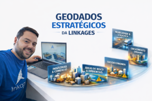
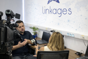
Linkages' work with georeferenced databases in Brazil
THE Links, as a mapping company headquartered in Unicamp's Scientific and Technological Park, is committed to an extremely challenging mission: to unify all georeferenced information in Brazil.
With this, it seeks to facilitate the access of academics, public managers and businessmen, expanding the vision of these agents on the true dynamics that happen in the country.
Of course, this is an ambitious and long-term project. However, our experts are already getting results on some fronts related to it.
For example, the AreaInsight: our urban land use visualization solution. This technology is mainly focused on builders and developers, as it facilitates the mapping of ideal land for each specific project.
If you want to know more about how Linkages can transform georeferenced data into valuable insights for your organization, just schedule a meeting with us.