
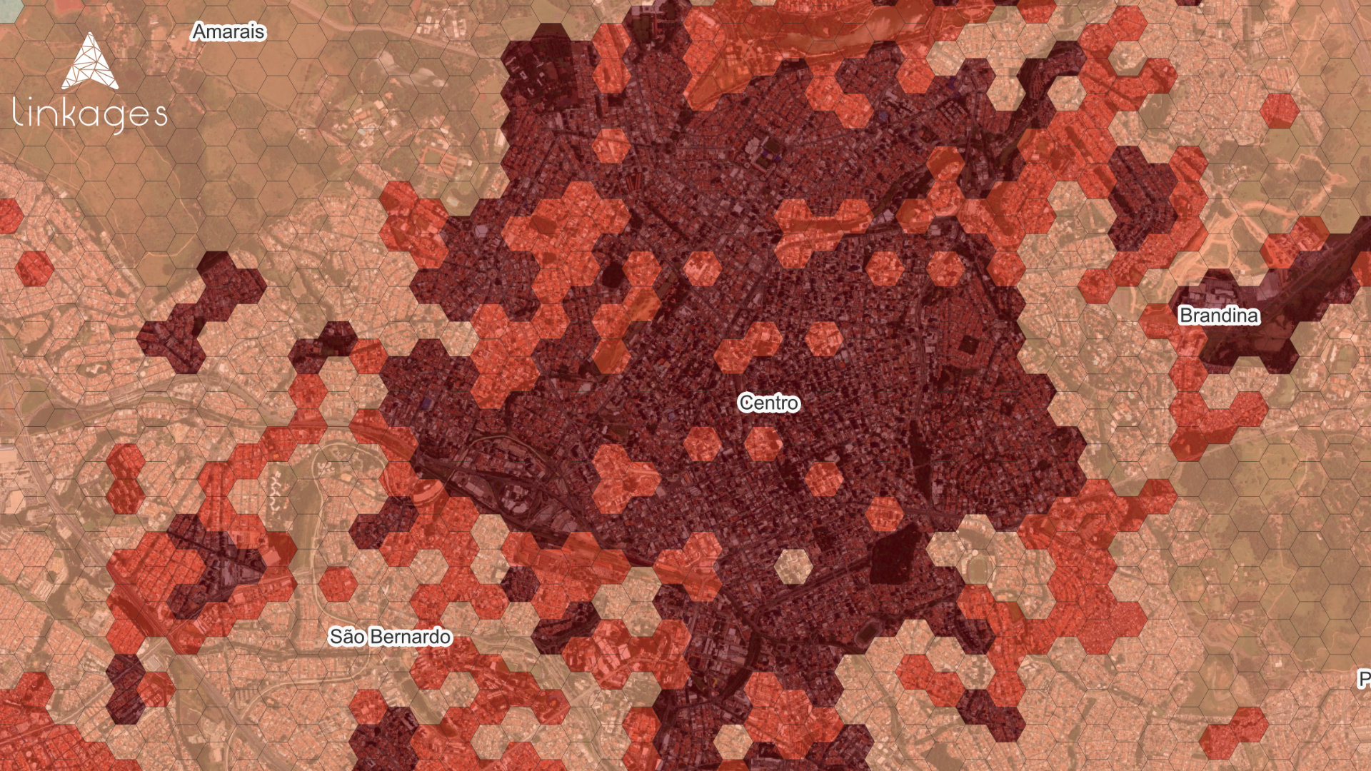
Campinas is changing. And this transformation can already be measured geographically. For decades, the city center concentrated the main economic, corporate, and urban flow of the region. But a geospatial analysis carried out by Geospatial Linkages This reveals that Campinas (SP) has entered a new phase of expansion: the city's corporate hub is no longer exclusively central and has begun to follow the road infrastructure even more closely.
Today, economic activity is rapidly redistributing towards logistics corridors, corporate offices, and new business hubs connected by the highways that structure the city. Urban geography is showing, in practice, where Campinas' economic future is taking shape.
The most important fact: the city center no longer alone concentrates the urban flow.
Our analysis considered four major variables: projected population density for 2026; number of businesses and employees; proximity to tourist hubs; and intensity of pedestrian and vehicular traffic.

The result shows something extremely relevant: The so-called "Expanded Center to the North" still leads the urban flow, with 36% of the total movement concentration. However, the peripheral and corporate neighborhoods already represent practically the same economic weight, totaling 35% of the total flow. This means that Campinas already operates on a polycentric logic.
The flow of people no longer depends exclusively on the traditional commerce of the city center and has begun to follow strategic areas linked to logistics, corporate offices, and business services.
Highways began to organize the city.
This is perhaps the main point of Campinas' urban transformation, in addition to its greatest competitive potential. Historically, highways have always driven the city's growth. But now they have ceased to be merely transportation infrastructure and have begun to act as direct vectors of economic development.
Analysis by Linkages Geoespacial shows that areas near the Dom Pedro, Anhanguera, Bandeirantes, and Santos Dumont highways are concentrating new centers of business activity, especially: logistics warehouses; corporate offices; business centers; distribution operations; and corporate support services.
The result is clear: Campinas is no longer growing solely "outward." It is growing in connection with logistical flows. And this completely changes the logic of the real estate market, mobility, and urban expansion.
The new corporate axis is already consolidated.
Regions such as Alphaville Campinas, Mansões Santo Antônio, Jardim Flamboyant, Swiss Park, the area surrounding Dom Pedro, and the peripheral logistics corridors already operate as economic extensions of the traditional city center.
Perhaps the most symbolic statistic is this: The area surrounding the city alone accounts for 351,300 tons of all urban traffic in Campinas. This is practically on par with the expanded city center. In practice, Campinas has created and reinforced a new corporate belt distributed around the highways.
The economic impact of this transformation
My interpretation is as follows: When we observe urban flows, we are observing a concentration of demand. And where there is demand, there is: increased property values, attraction of companies, expansion of services, corporate growth, increased consumption, and strengthened logistics.
Flow is one of the best early indicators of urban transformation. Therefore, understanding this spatial redistribution is essential for: real estate developers; retail chains; logistics companies; real estate funds; B2B operations; and commercial expansion.
Campinas is ceasing to have a single economic center. It is transforming into a city of multiple poles connected by infrastructure.
What does this reveal about the future of Brazilian cities?
Campinas is perhaps one of the clearest examples of a national trend. Brazilian cities are migrating from a radial model—entirely dependent on the center—to a distributed logic, connected by road axes and specialized business hubs.
Urban economic growth is now driven by: connectivity; travel time; logistical access; operational proximity; and territorial efficiency. And this completely changes how we should analyze cities.
Today, understanding flow is worth more than just understanding location. Because the economic value of urban areas is no longer just in "where." It's in "how" people, businesses, and operations move.
Analysis developed by Geospatial Linkages based on geospatial intelligence, population density, business concentration and urban flow dynamics in Campinas.