Geospatial Solutions

Areas for Prospecting
We identify potential areas for new developments based on qualified data.

Indication of Squares
We integrate geodata to indicate the points and locations with the greatest performance potential.

City Expansion
We identified the vectors of urban growth and the areas with potential for appreciation.

Map of the city
We modernized the municipal geoinformation portals with qualified data about the city.

Asset Radar
We monitor territorial assets, identifying potential opportunities, risks, and market trends.

Socio-environmental Study
We mapped communities, social dynamics, and the territorial impacts of environmental projects.

Integrated Geodata
We provide strategic socioeconomic, urban, and environmental data on integrated, qualified, and reliable bases.

Geospatial AI
We apply artificial intelligence to analyze territories, predict patterns, and recommend location decisions.
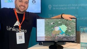
Our Ecosystem
Our market mapping method is based on broad, intelligent and automated geolocation data collection to provide fast results. We are immersed in the largest innovation ecosystems in Brazil! We are a daughter company of UNICAMP and have a space at USP - Campus São Paulo, in the NIDUS Program.


Intelligent real estate prospecting: how territorial data is redefining the choice of areas.
Choosing a good location has always been one of the most crucial factors for the success of a business. However, what was once guided mainly by experience, market perception, and specific opportunities, now requires a much more sophisticated level of analysis. In a scenario of squeezed margins, increased land acquisition costs, and greater competitiveness, making the wrong choice of location can mean losing millions. It is in this context that land prospecting, also called land scouting, evolves into a technical, structured, and data-driven process, ceasing to be a purely technical activity.
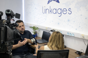
Discover the Linkages geodata ecosystem.
Making decisions about expansion, investment, or development without territorial intelligence is to take unnecessary risks. Territory is not just location—it's legislation, economic dynamics, population behavior, infrastructure, and urban transformation happening simultaneously. At Linkages Geoespacial, we integrate strategic layers of geodata that allow us to see what the market doesn't yet see. Below, you'll understand how each data set directly impacts decision-making. Zoning & Building Guidelines: Integrates detailed information on urban legislation, utilization coefficients, building height limits, occupancy rates, permitted uses, and construction restrictions. This geodata allows us to simulate construction potential, evaluate technical feasibility, and...
Investing in Brazil requires more than spreadsheets: The role of geodata in the Feasibility Study phase of Real Estate projects.
In Brazil, real estate investment decisions are still frequently made based on outdated, fragmented territorial data that has a low capacity to represent real urban dynamics. The time lag in public databases, the methodological heterogeneity between sources, and the low spatial resolution create a high-risk environment precisely at the most critical stage of the project: the feasibility study. In a country of continental dimensions, with accelerated urban growth, territorial informality, and rapid changes in land use and occupation, feasibility models that treat the territory as static tend to generate significant distortions in the assumptions of

The turning point: Why 8 out of 10 successful businesses love their location (and what challenges they hide)
The location of a business is more than just a point on a map; it's a strategic decision that can dictate long-term success or failure. We analyzed data from companies of various sizes and sectors to discover: what truly motivates the choice of an address, how entrepreneurs evaluate their decision, and what obstacles persist, even among the most satisfied. Get ready to unveil the X-ray of Business Location in Brazil. In practice, this is exactly the type of diagnosis that Linkages Geoespacial develops for companies that need to decide where to be located — and,