Geospatial Solutions

Areas for Prospecting
We identify potential areas for new developments based on qualified data.

Indication of Squares
We integrate geodata to indicate the points and locations with the greatest performance potential.

City Expansion
We identified the vectors of urban growth and the areas with potential for appreciation.

Map of the city
We modernized the municipal geoinformation portals with qualified data about the city.

Asset Radar
We monitor territorial assets, identifying potential opportunities, risks, and market trends.

Socio-environmental Study
We mapped communities, social dynamics, and the territorial impacts of environmental projects.

Integrated Geodata
We provide strategic socioeconomic, urban, and environmental data on integrated, qualified, and reliable bases.

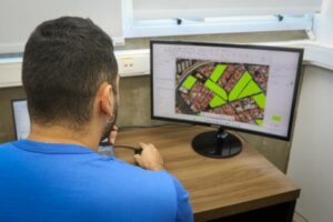
Geospatial AI
We apply artificial intelligence to analyze territories, predict patterns, and recommend location decisions.
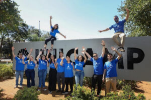
Our Ecosystem
Our market mapping method is based on broad, intelligent and automated geolocation data collection to provide fast results. We are immersed in the largest innovation ecosystems in Brazil! We are a daughter company of UNICAMP and have a space at USP - Campus São Paulo, in the NIDUS Program.


GIS Internship Opportunity at Linkages
Job Opening for Geography Students – Campinas or São Paulo If you enjoy exploring, analyzing data, and transforming maps into strategic knowledge, this opportunity is for you! We are looking for Geography students (2nd or 3rd year) who want to take their academic training a step further and begin a practical experience in a dynamic, innovative environment connected to the latest developments in geoprocessing, geospatial analysis, and market intelligence. Here, we value people with a curious, communicative, proactive, and organized attitude—someone who enjoys investigating information and building solid reasoning.

Location X-ray: What does location reveal about the success of companies?
When we think about business success, factors such as innovation, efficient management, marketing, or product quality immediately come to mind. But there's an element that often goes unnoticed—and that can determine the course of a business: location—even for companies that operate remotely! A company's location goes far beyond the address on its business card. It influences costs, customer access, logistics, brand visibility, and even the ability to attract talent. Being in the right place—whether on a busy street, in an industrial hub, or near the city—is crucial.
How to conduct market mapping in a strategic and data-driven way?
Conducting market mapping is much more than simply gathering random numbers or listing potential customers. It's a structured process that combines research, analysis, and strategic interpretation to understand competitive dynamics, market size, existing opportunities, risks, and barriers to entry. This type of study allows a company to make decisions based on evidence, not assumptions. Many startups and small businesses, for example, often invest time and resources in segments that lack proven demand, while others miss good opportunities by failing to see adjacent or emerging markets.
Linkages wins support from FAPESP to develop pioneering AI model with geospatial analysis for market mapping
Artificial Intelligence will enable more precise and agile geospatial analyses to map the best locations for commercial points for entrepreneurs, new markets for franchises, and new real estate developments. Linkages has just secured important funding to develop a pioneering project in its sector. The São Paulo Research Foundation (FAPESP) approved a funding investment for the startup to develop a machine learning model applied to geospatial analysis for generating market insights. To date, there are no records of companies in the country using this type of tool.